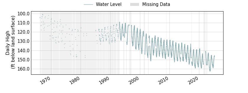
State Well Number 4807516 is 149.13 feet below land surface on 2025-04-25
Well Information
All data are provisional and subject to revision. The Texas Water Development Board (TWDB) specifically disclaims any and all liability for any claims or damages that may result from providing these data. For additional information, including water level and water quality data, search the TWDB Groundwater Database (GWDB).
| County | Hudspeth |
| State Well Number | 4807516 |
| Status | Active |
| Period of Record | 1966-03-10 to 2025-04-25 |
| Entity/Cooperator | Texas Water Development Board |
| Aquifer | Bone Spring-Victorio Peak |
| Formation | Bone Spring and Victorio Peak Limestones |
| Aquifer Type | Unconfined |
| Well Depth (ft below land surface) | 300.00 |
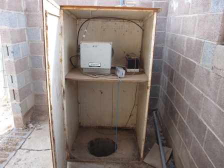
| Instrument | Transducer |
| Transmission | Satellite |
| Groundwater Conservation District | Hudspeth County UWCD #1 |
| Groundwater Management Area | 4 |
| Estimated Land Elevation (ft above sea level) | 3702 |
| Location (lat, long) | (31.9435306, -105.2019611) |
| Download Data | csv json txt |
Data Summary
| Date |
Daily High Water Level (ft below land surface) |
Height Below Most Recent (ft) |
|
|---|---|---|---|
| Most recent | 2025-04-25 | 149.13 | - n.a. - |
| 1 day prior | 2025-04-24 | 148.97 | -0.16 |
| 2 days prior | 2025-04-23 | 148.74 | -0.39 |
| 1 week prior | 2025-04-18 | 148.21 | -0.92 |
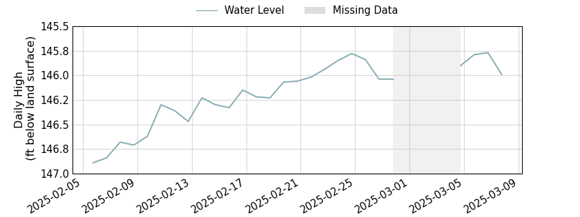
| 1 month prior | 2025-03-25 | 146.30 | -2.83 |
| 3 months prior | 2025-01-25 | 147.09 | -2.04 |
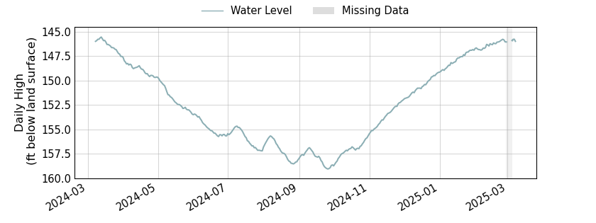
| 6 months prior | 2024-10-25 | 156.66 | 7.53 |
| 1 year prior | 2024-04-25 | 149.47 | 0.34 |
| oldest | 1966-03-10 | 103.92 | -45.21 |