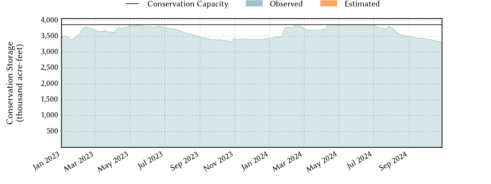
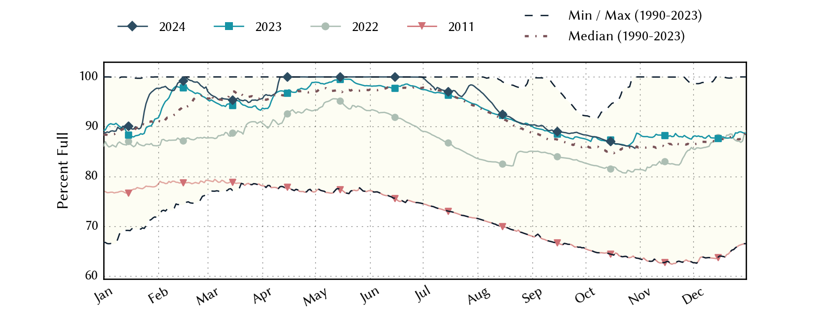
Sabine River Basin Reservoirs: Monitored Water Supply Reservoirs are 99.6% full on 2025-04-26
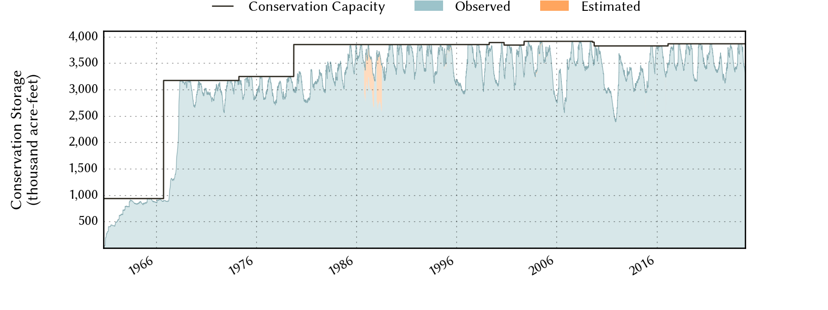
Historical Data
| Date | Percent Full |
Reservoir Storage (acre-ft) |
Conservation Storage (acre-ft) |
Conservation Capacity (acre-ft) |
|
|---|---|---|---|---|---|
| Today | 2025-04-26 | 99.6 | 6,135,564 | 3,851,158 | 3,867,301 |
| Yesterday | 2025-04-25 | 99.7 | 6,143,651 | 3,854,595 | 3,867,301 |
| 2 days ago | 2025-04-24 | 99.5 | 6,133,704 | 3,849,432 | 3,867,301 |
| 1 week ago | 2025-04-19 | 98.5 | 6,061,699 | 3,810,792 | 3,867,301 |
| 1 month ago | 2025-03-26 | 95.9 | 5,842,715 | 3,709,193 | 3,867,301 |
| 3 months ago | 2025-01-26 | 89.9 | 5,482,414 | 3,476,734 | 3,867,301 |
| 6 months ago | 2024-10-26 | 86.1 | 5,224,980 | 3,328,690 | 3,867,301 |
| 1 year ago | 2024-04-26 | 100.0 | 6,199,226 | 3,866,743 | 3,867,301 |
*
Percent Full is based on Conservation Storage and Conservation Capacity and doesn't account for storage in flood pool.
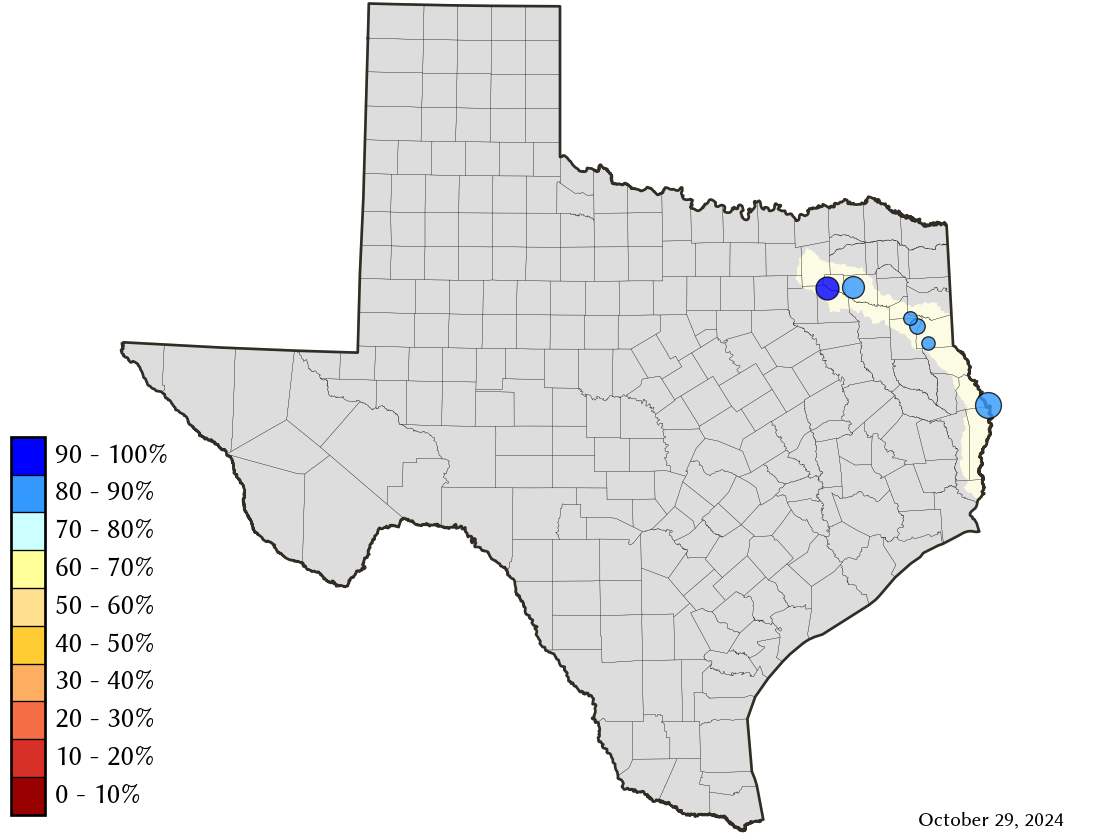
Area Map
Reservoir Storage
| Reservoir | Type | Percent Full |
Water Level (ft) |
Height Above Conservation Pool (ft) |
Reservoir Storage (acre-ft) |
Conservation Storage (acre-ft) |
Conservation Capacity (acre-ft) |
Surface Area (acres) |
|---|---|---|---|---|---|---|---|---|
| Cherokee |

|
100.0 | 280.30 | 0.30 | 46,031 | 40,094 | 40,094 | - n.a. - |
| Fork |
|
99.2 | 402.81 | -0.19 | 631,483 | 600,040 | 605,061 | 26,304 |
| Martin |
|
99.8 | 305.97 | -0.03 | 75,578 | 75,578 | 75,726 | 4,949 |
| Murvaul |
|
100.0 | 265.61 | 0.31 | 39,354 | 38,285 | 38,285 | - n.a. - |
| Tawakoni |
|
100.0 | 437.94 | 0.44 | 888,066 | 871,685 | 871,685 | - n.a. - |
| Toledo Bend 1 |
|
99.5 | 171.78 | -0.22 | 4,455,052 | 2,225,476 | 2,236,450 | 181,439 |
footnotes
1
Toledo Bend Reservoir straddles the border of Texas and Louisiana, Texas has rights to 50% of Toledo Bend Reservoir's total conservation capacity. Percent full, conservation storage and conservation capacity are based on the Texas share.