Abilene Area Reservoirs: Monitored Water Supply Reservoirs are 45.1% full on 2025-04-26
Historical Data
| Date | Percent Full |
Reservoir Storage (acre-ft) |
Conservation Storage (acre-ft) |
Conservation Capacity (acre-ft) |
|
|---|---|---|---|---|---|
| Today | 2025-04-26 | 45.1 | 431,108 | 426,226 | 945,568 |
| Yesterday | 2025-04-25 | 45.0 | 430,570 | 425,688 | 945,568 |
| 2 days ago | 2025-04-24 | 45.0 | 430,032 | 425,150 | 945,568 |
| 1 week ago | 2025-04-19 | 42.3 | 404,810 | 399,928 | 945,568 |
| 1 month ago | 2025-03-26 | 42.6 | 407,999 | 403,117 | 945,568 |
| 3 months ago | 2025-01-26 | 43.7 | 417,738 | 412,856 | 945,568 |
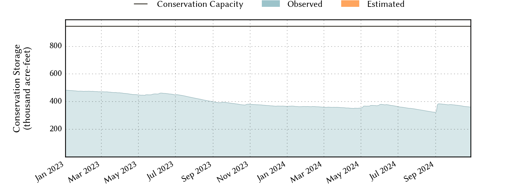
| 6 months ago | 2024-10-26 | 38.2 | 366,243 | 361,361 | 945,568 |
| 1 year ago | 2024-04-26 | 37.2 | 356,199 | 351,317 | 945,568 |
*
Percent Full is based on Conservation Storage and Conservation Capacity and doesn't account for storage in flood pool.
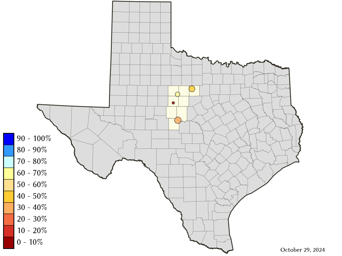
Area Map
Reservoir Storage
| Reservoir | Type | Percent Full |
Water Level (ft) |
Height Above Conservation Pool (ft) |
Reservoir Storage (acre-ft) |
Conservation Storage (acre-ft) |
Conservation Capacity (acre-ft) |
Surface Area (acres) |
|---|---|---|---|---|---|---|---|---|
| Abilene |

|
6.7 | 1,990.87 | -21.43 | 531 | 531 | 7,900 | 126 |
| Fort Phantom Hill |
|
71.9 | 1,630.26 | -5.64 | 50,364 | 50,358 | 70,030 | 3,101 |
| Hubbard Creek |
|
49.0 | 1,170.67 | -12.64 | 158,327 | 153,451 | 313,298 | 9,834 |
| O H Ivie |
|
40.0 | 1,528.57 | -22.93 | 221,886 | 221,886 | 554,340 | - n.a. - |